


Trainsity Kuala Lumpur LRT KTM
Trainsity Kuala Lumpur LRT KTM açıklaması
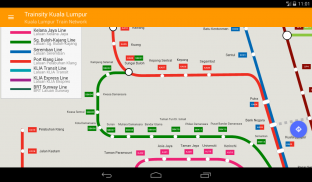
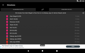
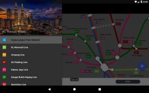
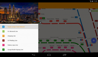
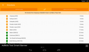
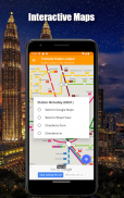
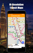
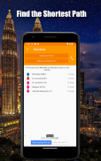
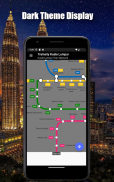
KTT Komuter hatları, RapidKL hatları ve BRT Sunway hattı da dahil olmak üzere KLIA Express Tren Bağlantısı hatlarının yüksek çözünürlüklü vektör haritalarını kullanarak Kuala Lumpur kentinde yolunuzu bulun. Haritaların dosya boyutu küçük fakat ayak parmakları çok fazla büyütülmüş durumda ve internete bağlanmadan çevrimdışı çalışabiliyorlar. Kullanıcılar Google Haritalar veya Sokak Görünümü'nü açmak için tren istasyon etiketlerini tıklayabilir, burada çevreleyen alanı görselleştirmek ve / veya yol tarifleri için yönlendirme yapmak için Google uygulamalarının tüm işlevlerini kullanabilirler. Aynı zamanda, bir istasyondan bir başka istasyona seyahat etmenin en iyi yolunu yön dağılımı ve zamanlamaları (gerçek seyahat zamanından farklı olabilir) hesaplamak için bir çevrimdışı işlev de vardır.
* Şimdi karanlık modda
Trainsity Kuala Lumpur LRT KTM - Sürüm 2.10.0
(15-01-2025)Trainsity Kuala Lumpur LRT KTM - APK Bilgisi
APK sürümü: 2.10.0Paket: com.dom925.trainsity.kualalumpurTrainsity Kuala Lumpur LRT KTM uygulamasının en son sürümü
Diğer sürümler


Aynı kategorideki uygulamalar

Hoşuna gidebilecekler...


